Integrated real-time monitoring and early warning systems for the prevention and management of natural hazards — floods and river overflows, debris flows, landslides and rockfalls, avalanches, road safety in extreme weather conditions.
Solutions designed for Civil Protection services, municipal administrations, land management bodies and utilities — supporting risk prevention, rapid response and operational coordination.
Why an early warning system, today
Over the past 20–30 years, scientific evidence has shown a clear increase in both the frequency and the intensity of extreme meteorological and hydrological events, driven by climate change. Precipitation extremes, droughts and compound events are becoming more frequent and more severe — especially in areas already prone to natural hazards.
According to the European State of the Climate 2024 report: 30% of the continent’s river network recorded “high” flood discharges, and 12% reached “severe” levels. Floods and storms affected around 413,000 people and caused at least 335 fatalities. Economic losses exceeded 18 billion euro.
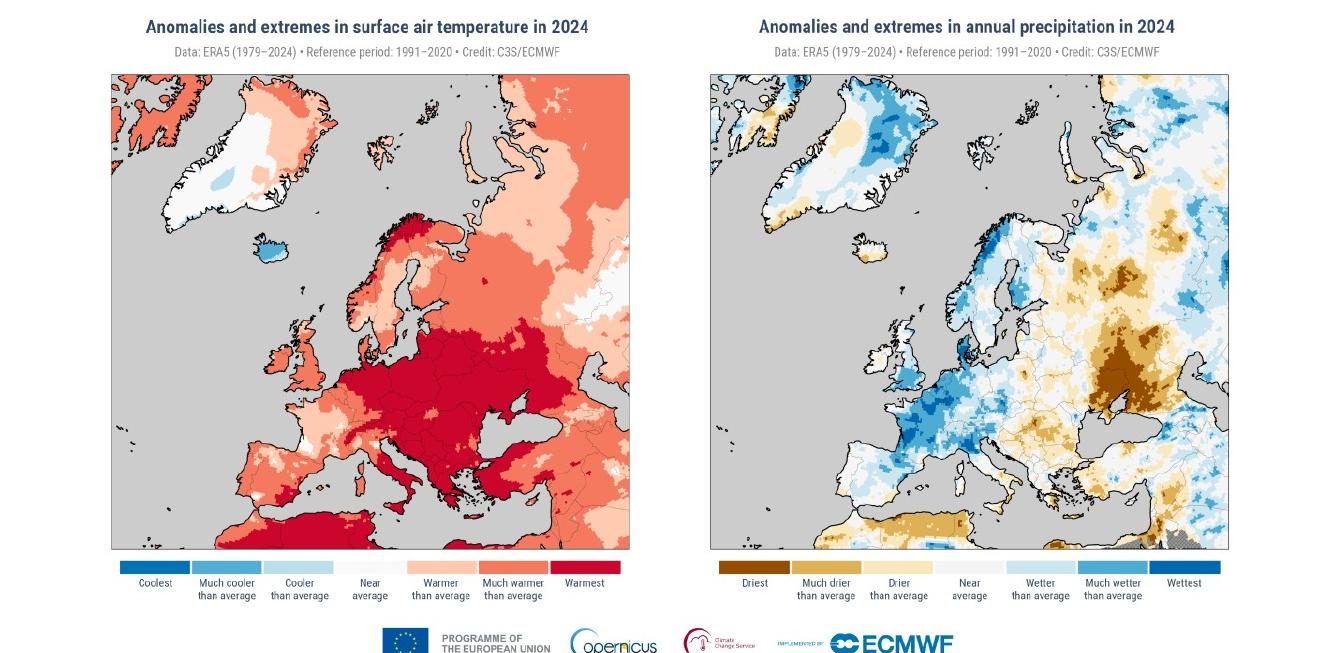
The acceleration of these events means shorter warning times and lower predictability — raising the bar for real-time monitoring and early detection capabilities. An effective system must detect both gradual precursors (soil moisture build-up, slope deformation) and rapid-onset signals (bursts of intense rainfall, water-level thresholds being exceeded).
An integrated approach — three layers of defence
Risk mitigation cannot rely on a single measure. It requires an integrated strategy across three complementary layers:
1. Land planning and management
Reduces where and how often hazards can occur: sustainable land-use planning, reforestation, slope stabilisation, improved drainage, maintenance of river corridors and floodplains to preserve their natural attenuation capacity.
2. Structural protection works
Reduce the extent of damage: levees, retention basins, redesign of bridges and infrastructure, sabo dams, rockfall barriers. Structural works are essential but do not eliminate risk — every structure has a design threshold, and events of greater magnitude can still cause damage.
3. Monitoring and early warning
Reduces the severity of the impact on people and infrastructure, providing precious time and ensuring that interventions are based on objective information. Continuous observation of the key hydrological and geological parameters, automated alarm activation, integration with Civil Protection protocols.
Monitoring and alarm — two complementary systems
| System type | Objective | Reaction time |
|---|---|---|
| Monitoring system | Detect precursor signals (slow deformation, rising water levels) | Hours – days |
| Alarm system | Detect rapid events and trigger an immediate response | Seconds – minutes |
Application scenarios
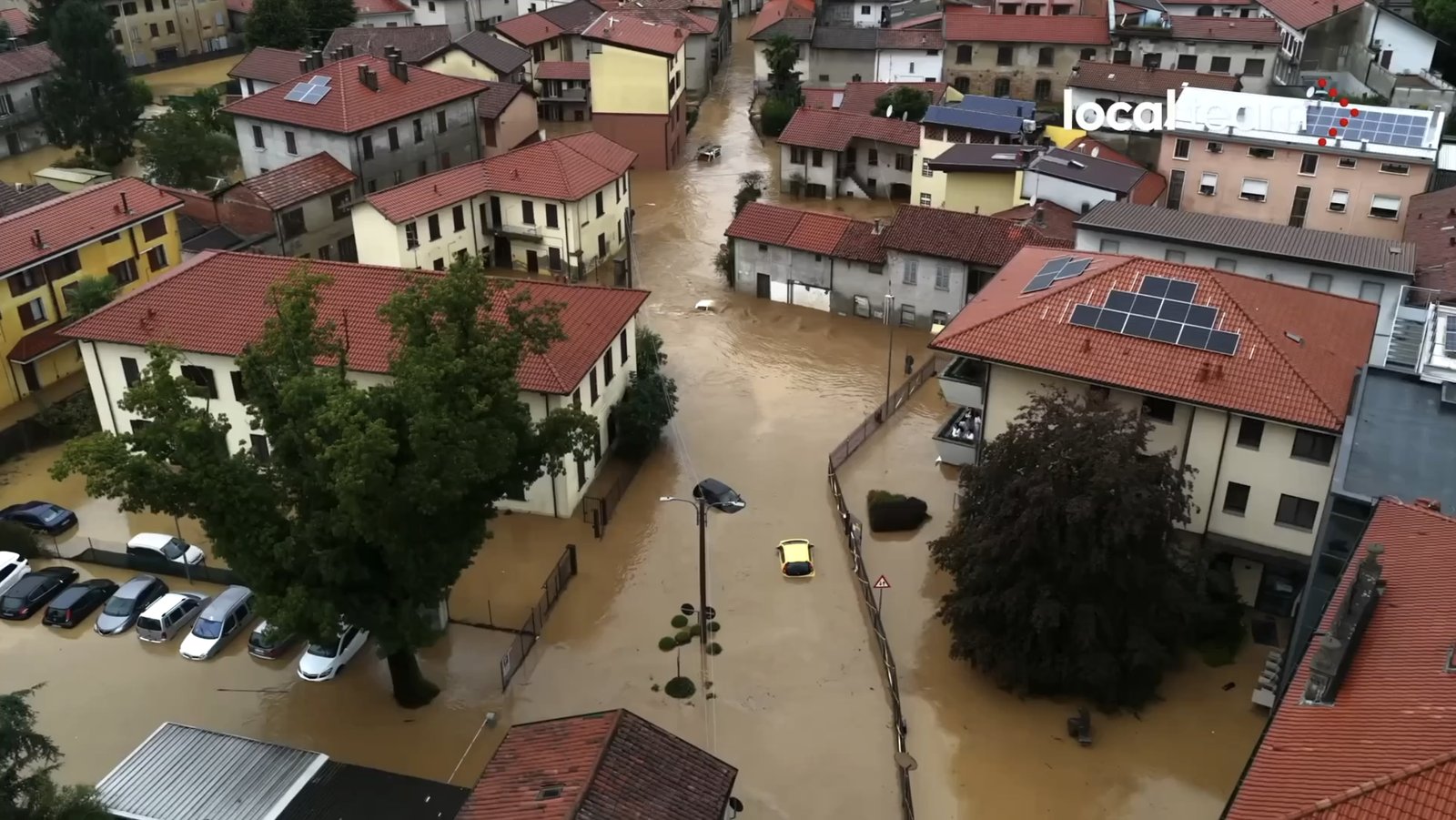
Floods and river overflows
Monitoring strategy: radar and ultrasonic water-level sensors for watercourses, rain gauges, automatic cameras for visual confirmation. Alerting: real-time thresholds that trigger alerts to local authorities and the automatic closure of fords, bridges or road underpasses.
Debris flows
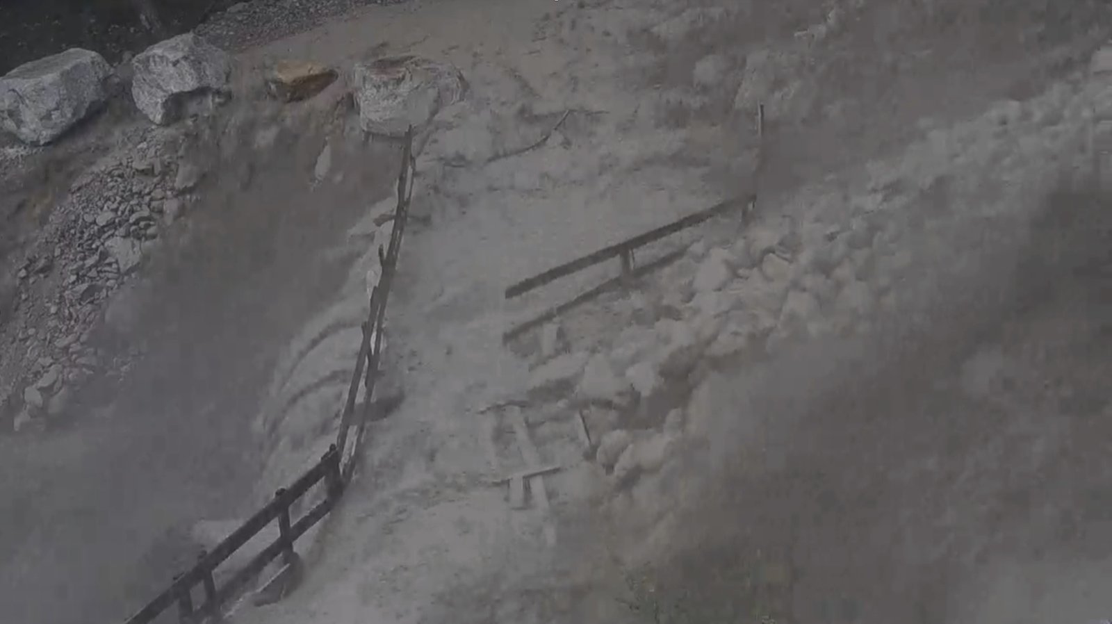
Fast-moving, high-density mixtures of water, soil and rock, triggered by intense rainfall or snowmelt. Monitoring strategy: upstream impact sensors, trip wires and seismic sensors to detect the first movements, early warning from weather stations. Alerting: automatic barriers, traffic lights and sirens along channels or roads.
Landslides and rockfalls
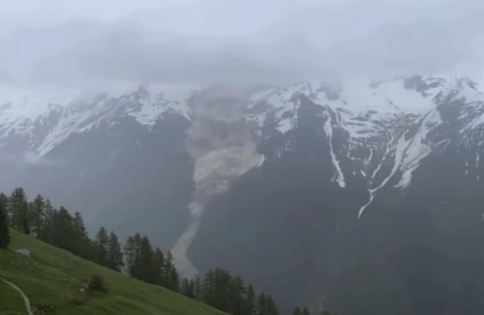
Continuous deformation monitoring for the early detection of slope instability. Monitoring strategy: interferometric and ground-based InSAR radar, Doppler radar for real-time detection of fast movements, GNSS/GPS networks for surface displacement, trip wires and accelerometers on rockfall barriers, crack meters, inclinometers and extensometers for in-depth monitoring. Alerting: automatic barriers, traffic lights, sirens and alerts to local authorities.
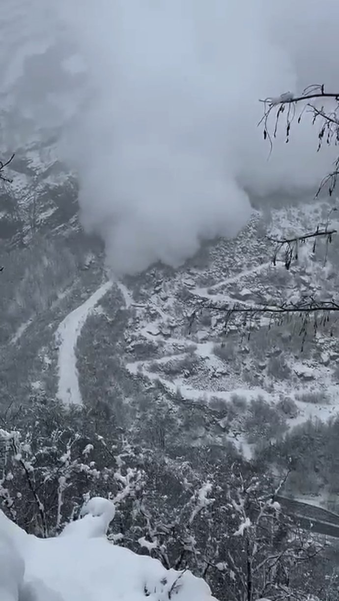
Avalanches
Monitoring strategy: Doppler radar for wide-area avalanche detection, impact sensors for narrow gullies, weather sensors for snow accumulation and thermal gradients. Alerting: automatic closure systems (barriers, traffic lights, sirens) and real-time alerts to local authorities.
Road safety and atmospheric hazards
Monitoring strategy: road weather stations (rainfall intensity, ice formation, precipitation type, humidity, visibility, air temperature), in-pavement sensors (asphalt temperature, grip, residual salt), verification by automatic cameras. Alerting: activation of variable message signs, salt-spreading alerts, warnings to drivers.
Our solutions
Tecnica Formazione Sicurezza provides integrated, autonomous monitoring and early warning systems designed for multi-hazard environments. Our solutions combine:
- High-performance sensors and redundant data transmission technologies (4G/5G, low-power long-range wireless protocol, satellite communication) that ensure continuity of real-time information.
- Cloud platform for data visualisation, long-term archiving and real-time consultation of telemetry and camera images.
- On-site alerting systems for road users and field personnel (traffic lights, sirens, barriers).
- Remote alerting systems for technical staff, Civil Protection agencies, road management services and municipal authorities.
- Public alerting tools for citizen safety and community awareness.
- Integrated operating procedures, aligned with Civil Protection risk management plans, for a coordinated and timely response.
Example installations
A few representative cases from the projects we have delivered:
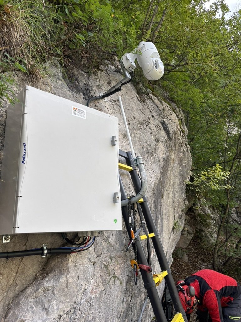
Rock face monitoring
2 4K cameras (fixed + PTZ) with automatic image analysis, 2 site sirens, 11 trip-wire sensors on the rockfall barriers, 1 alternating one-way traffic light. 400 W photovoltaic power supply with a hybrid generator for the winter period. 4G connectivity + low-power long-range wireless protocol.
Landslide slope monitoring
1 Doppler radar with high-resolution camera, 2 site sirens, 2 alternating one-way traffic lights, 3 cameras to monitor the phenomenon. 230 Vac power supply with backup. 4G connectivity + low-power long-range wireless protocol.
Glacier collapse monitoring and traffic management
1 Doppler radar, 8 traffic lights for traffic control, 2 alternating one-way traffic lights, 5 vehicle radars, 5 vehicle-counting cameras, 1 4K PTZ camera for the watercourse. 4G connectivity + low-power long-range wireless protocol.
Road weather monitoring
18 weather stations acquiring environmental and road data, dynamic message signs (DMS) along the route, integration with public weather stations. Fibre-optic connectivity.
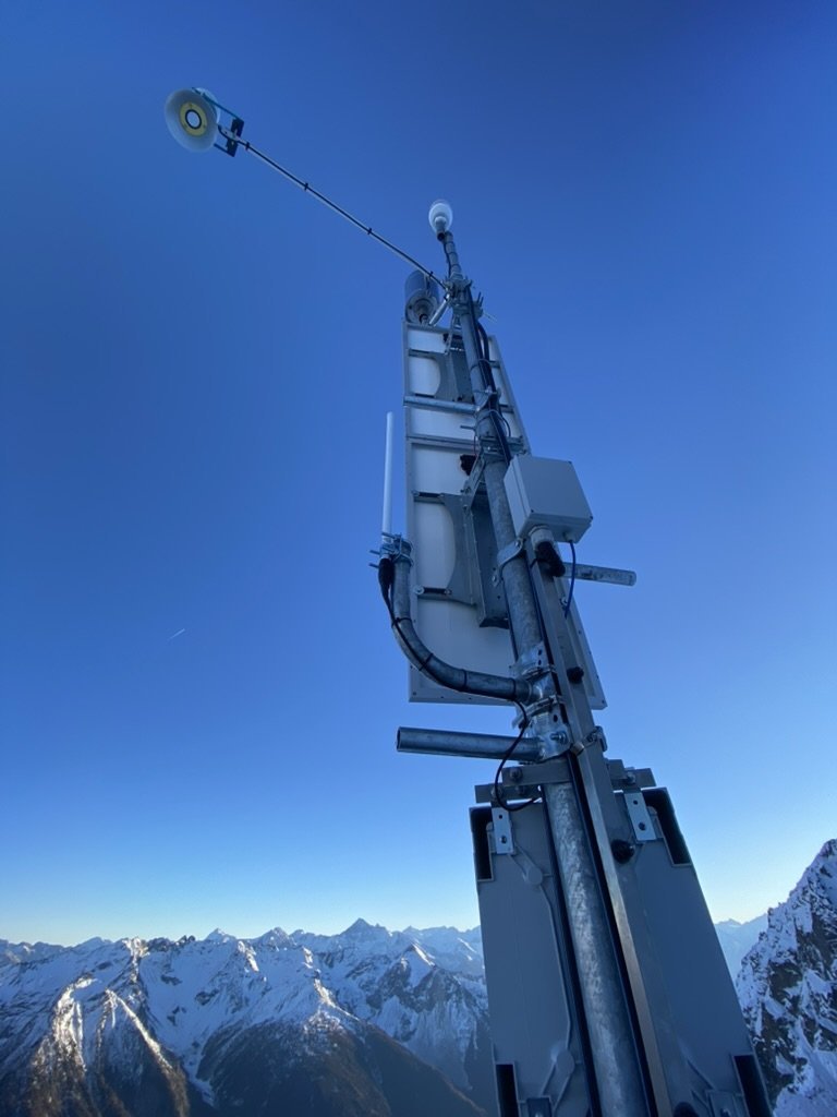
Automatic weather station (AWS)
Snow depth sensor, rain gauge, multi-parameter sensor (temperature, pressure, precipitation type and intensity, humidity, wind), thermistor chain for snowpack stratigraphy. 200 W photovoltaic power supply with LiFePO₄ backup. Low-power long-range wireless protocol connectivity.
Technology focus — Doppler radar
Doppler radar continuously emits electromagnetic waves using FMCW technology. When an avalanche, a debris flow or a moving mass enters the field of view, the waves are reflected with a frequency shift proportional to the target’s velocity. The Doppler shift makes it possible to detect fast movements even at long range and to distinguish between events of different magnitude.
The radar builds a 4D map (range, azimuth, elevation, velocity) and processes the signal, reconstructing in real time the release point, direction, front velocity and evolution of the flow. Advanced algorithms distinguish real activity from atmospheric interference, reducing false alarms.
Jarvis software platform
Monitoring data flows into the Jarvis platform, a modular system for integrated event and emergency management that can be used as an ICS (Incident Command System) or according to the Augustus standard of the Italian Civil Protection. Jarvis is natively multilingual, suitable for border areas and cross-border cooperation.

The platform brings together asset and resource management, staff training tracking, geospatial data (GIS), Civil Protection planning tools, role-based communication, an operations log, team dispatching and alerting, and real-time tracking with georeferenced media.
Multichannel alerting system
Real-time push notifications via the Jarvis Mobile app (iOS and Android) for operators and technicians. Direct access to data on the phenomenon, with charts, telemetry and trends. Integration with local alerting systems (traffic lights, sirens) via low-power long-range wireless protocol modules. Structured communication to the public through the Jarvis Public app, with multichannel notifications (push, SMS, email, Telegram, WhatsApp).


ACN qualification and data portability
The Jarvis cloud service holds the ACN qualification (Italian National Cybersecurity Agency), a requirement under current legislation for cloud services intended for the Public Administration. It ensures compliance with national security requirements, encryption, identity management and continuous monitoring.
Data export in open formats (CSV, JSON, XML), documented and versioned REST APIs for integration with GIS platforms, SCADA systems, control rooms and single emergency response centres. Cloud architecture with continuous synchronisation and long-term historical retention.
Ready to start a project?
We design, supply, install and operate monitoring and early warning systems tailored to the territory and the operational scale. For Civil Protection, municipalities, land reclamation consortia, road and rail operators, utilities and industrial operators exposed to natural hazards.
360-degree monitoring
Monitor the hazards across your territory: snow, avalanches, debris flows, strong winds, rain and thunderstorms can cause serious damage and put the population at risk
Advanced sensors
A sensor network of high-tech, low-power devices collects parameters and forwards them in real time to the supervision system
Data collection
The data collected by the sensors is stored historically for in-depth analysis. It can be made available for consultation to external services such as the avalanche commission, the geological survey, etc.
Reliable and efficient alerting
The analysis algorithm compares multiple data sources (sensors installed in the field, video images, avalanche bulletin, weather forecasts) to issue alerts with a high level of reliability
Alert level management
You can set different alert thresholds or pre-alert thresholds, so that communication with field staff and with the population can be managed flexibly
Message distribution – real-time alerts
Using the most widespread communication channels: alerts via smartphone App with read receipt, SMS, E-mail, Websites, Social networks, activation of sirens, alarms and VMS (variable message signs) via dedicated Jarvis Public hardware